We review: LandView, iLandman, Landdox, MyQuorum Land on Demand, WolfePak LandPro and LandVantage
"What's the best land management software?" We get asked this from time to time, so here's our candid review of the 5 best land management software solutions.
Much of today’s land management software has been around for decades, but some exciting newcomers are shaking things up. What’s the best land software?
Well, it depends on quite a number of factors. And, if you’re like most companies you're likely to make the choice based on the experience level of your staff.
In this review we’ll cover pros and cons of different land software. Feel free to offer suggestions or corrections. Things do change fast, after all, with today's oilfield data management.
And in full disclosure, we're not a land management software.
What do we do? We integrate oil and gas data from digital and paper documents into land systems.

Download Our Digital Oilfield Guide
At least 90% of all oil and gas data is unstructured. Learn how to extract and leverage this data with a solution that supports all oil and gas documents and thousands of data elements.
Download here:
What we’ll cover in this review:
- The difference between lease-based and tract-based solutions
- TLDR: Choose a land software in 30 seconds
- A review of LandView
- A review of iLandman
- A review of Landdox
- A review of MyQuorum Land on Demand
- A review of LandPro
- A review of LandVantage
- Land Software Data Integration Tools

The Difference Between Lease-Based and Tract-Based Land Software Solutions
This is an important consideration for both mapping and reporting. In a tract-based system, you set up a tract, set up every mineral owner on the tract, and then attach leases to the mineral owners.
You must be aware of what’s already in the system, and things tie together neatly. This takes a little more legwork upfront vs. a lease-based system.
 In a lease-based system you start with the lease and you only care about what’s on that lease. Leases may cover different (and overlapping!) acreages or there may be different mineral owners on the same tract.
This could be a bit of a problem later on in reporting when you want to look at more than one lease at a time. You also must prepare for some amount of manual manipulation to deal with leases that cover the same acreage.
Some lease-based land software solutions do a better job than others at allowing users to specify what acreages might be overlapping. Look for a strong GIS map integration.
What’s better – a lease or tract-based system?
The more information you have, the better a tract-based system will be. However, the most important consideration for a new company setting up (or if your needs are changing) is what you want to do with your data. Is mapping the most important thing? Ease of use? Will you use the system from the time the lease goes in to the payment of the Division Order? Or are you just housing data for reporting?
The same things can be achieved with a tract- or lease-based system, but with lease-based systems it’s easier to do data entry, and with tract-based systems, it’s easier to do reporting.
For example, how easy is it for you to generate an accurate lease schedule by tract out of a lease-based system? Difficult. Out of a tract-based system? Easy. But remember it would have taken you as much as twice as long to get the information into the system.
With a solid requirements list in hand, this guide will help you make the best decision on what the best land software is for your company.
TLDR: Choose a Land Software in 30 Seconds
If you’re a tech-forward firm interested in building out your own workflows and customizations, take a look at Landdox (which was acquired by Quorum) or LandView. If you’re a small/medium operator, take a look at LandPro.
 If you just care about getting a system set up quickly for just the basics (maybe you’re just flipping land) and you feel like you have everything under control we recommend MyQuorum Land On Demand.
Need to go live immediately with a robust easy to learn system that includes everything you need out-of-the-box? LandVantage. If you’re in the middle of these options, iLandMan (acquired by P2 Energy in 2018) is a safe bet.
Quorum and iLandMan are certainly the two most popular and have the lowest barrier to entry mainly because more Lease Analysts are comfortable with them. This familiarity obviously reduces the training burden, but with new entrants like LandVantage, it's worth taking a look at something new.

A review of LandView
The Peloton LandView Platform was developed in partnership with Microsoft's Azure technology and provides a very modern solution. This customizable platform delivers a seamless user experience to help organizations achieve maximum value from Well Data Lifecycle, Production Data Lifecycle, and Land Data Management solutions. Peloton’s Land Data Management solution encompasses workflows to lease acquisition, ownership history, payments, expirations, and related obligations. Their LandView software is part of Peloton's integrated Land Data Management solution and is a complete system that tracks every agreement throughout the land process.
These file types are associated with their respective well, facilities and business associates, in addition to the related files within the system. You can use it to track obligations, payments, royalties, acreage, and division of interest. This data can be viewed in the title chain visualizer and reporting tools.
- Contract, Mineral & Surface Lease Management
- Title Chain Visualizer
- Obligations & Payments
- Acreage Reporting
- Royalty Management
- Track Wells & Facilities
- Units, Pooling & Joint Ventures
- Peloton Map
Maps
Peloton Map is a cloud-based application designed to allow for the visualization, query, and analysis of Peloton data. It extends ESRI’s ArcGIS internet mapping platform, integrates directly with LandView via web-based communication protocols and leverages customers’ already existing mapping investments.
Spatial representation of LandView data is generated by analyzing formatted land legal descriptions in real-time and visualizing it on the map. There is bi-directional, context-sensitive navigation between the LandView and Peloton Map applications. Users can create custom maps, run the same queries they run in LandView to find information, and perform analyses across data sets to build a comprehensive picture of an area of interest.
Reporting
Reports can be created in LandView using the Query Files tool. Users can use multiple filters to identify any land records and create customized reports, adding as many columns of data as necessary. These queries can be saved and shared in LandView if they will be frequently utilized or leveraged for other filtering purposes for handling of expirations, non-payment obligations and payments.
All other formatted reporting documents that are based on data stored in LandView can be built to meet individual client needs. Also, audit reporting is available across all LandView records and can be reported at the system, file, or file tract levels.
Licensing
Peloton licenses are all user-based in conjunction with all Peloton products on the Peloton Platform. LandView instances are immediately available upon licensing, and are pre-packaged with all best practice configurations to make deployments simple and easy. There are no additional modules to license, and no restrictions on data volumes.
Payment Obligation Reports
Payment Obligation Reports can be accessed through the Payment Search workflow. Payment Search is the first step in the payment management process. Payments themselves are searched, rather than files or tracts. The payment a given file is attached to will be shown in the search results.
Payment Search allows the user to select a group of payments on which to operate. It also shows various QA checks on the payments to help identify data problems which would prevent a payment rollover process from running.
To start filtering payments, users can begin with a saved query filtering for only active payments that are due anytime up to the next three months, including historical payments intended to be processed now. A user can also search for payments less than the users’ payment approval threshold, or payments with a specific AFE or Cost Center.
There are many filters available so that the desired payments are identified by due date, file status, etc., and all filters can be combined.
Royalty Division Orders / Division Order Calculations
LandView has a dedicated file, Category for Division Orders. These files can be created manually by the user, created programmatically based on ownership information stored on associated mineral leases, or by a combination of existing lease data and manual edits.
Each Division Order will store the relationship between Working and Royalty owners, the Tract Participation Factors, and the summarized Gross and Net interest for all included parties.
All this information can then be passed to the Revenue Accounting Team for processing and distributions.
Joint Interest Billing
Joint Interest Billing decks also use the Division Order file Category. LandView can store JIB interest information either on stand-alone JIB files or combined with Revenue decks by using the same GWI for both deck types. JIB-specific exports can be then generated for use by the JVA team.
A review of iLandman
iLandMan was built by landmen and has been a trusted software for nearly 20 years. Initially released in 2006, new features and updates are regularly added to meet the needs of customers.
iLandMan was acquired by P2 Energy Solutions in 2018.
With thousands of users, iLandman is probably the most well-known software in the land industry. They were acquired by P2 Energy Solutions in 2018 which added integrations with Tobin data, and Bolo Accounting.
 iLandMan is a hosted, tract-based solution that supports the entire value chain of a landman's work, from contracts to payments. Overall, the solution is very user-friendly and with a few days of training, you'll be fully up and running.
If you want something web-based and need a tract-based system with a robust API this is a good choice. However, they do have some catching up to do with Payment Obligations, Mapping, and Transfer of Interest.
One of iLandMan's strongest features is its ability to handle contracts (oil and gas leases) with multiple tracts and multiple mineral owners within lease agreements. iLandMan does this with unique identifiers that are tract or formation-based rather than contract-based.
Maps
iLandMan's maps are Arc-based. Data is fully integrated with their proprietary analytics and back-end data set. Users can view their own as well as competitor's lease positions, and mineral lease holds, tract status, lease expirations, seismic maps, and more. Although not great for printing, they offer great map tools for online mapping.
iLandMan includes the necessary ArcGIS license. Updates to the platform now enable users to upload multiple polygons at one time. Alternatively, for a large data set, iLandMan’s professional services can be engaged to perform a custom upload.
Reporting
iLandMan's history in working land shows in their built-in reports. There are over 100 pre-configured reports, and an intuitive drag-and-drop report builder for generating custom reports in Excel. All reports can be output as PDF or in Excel format.
However, building complex reports is usually best left to iLandMan's professional services team. Reports can also be run from elected areas of interest from their interactive map. More complex reports can be slow to download.
Be aware there are some frustrating nuances. Because there's no "Search All" field, it's easy to accidentally add an Owner multiple times when you don't have the Tax ID or Vendor code available. Analysts have to be very careful or a cleanup project will be in order.
Licensing
Licensing in iLandMan provides extremely granular control over a user's access to stored data. Project permissions can be set by project or view / edit / add / delete permissions based on broker cost, payments, contract preparation, contracts, etc.
Users are set up by a license administrator and can be restricted to only assigned projects or tracts that he or she created. They certainly have the most robust user-access control on the market.
There are no restrictions on the number of projects, or stored data.
Pricing is based on an annual license fee plus monthly user fees.
Payment Obligations
With iLandMan's well data integration, an Obligations Schedule can be created for vertical/horizontal Pugh Clauses, lease extensions, Shut-in Payments and more. However, running the Payment Obligations reporting is tedious. Reports are run by Obligation Type, so it could be a little more comprehensive. Take note that the report doesn’t export natively to Excel, so if your account system isn’t integrated, you’ll need to plan for that.
Division Order Calculations
While not as robust as WolfePak LandPro, iLandMan’s Division Order calculations are definitely sufficient for 70 -80% of normal cases. The solution will automatically generate Royalty Division Orders with a point-and-click map interface. Where it struggles, for example is with different calculations at different depths, and multiple wells within a single unit with different overrides.
Joint Interest Billing Deck
Users can quickly generate interest decks and view working interest before and after points of obligation, and override Royalty Interest as needed.
A Review of Landdox
Landdox is an exciting new entrant to tract-based land software. Founded in 2015, their cloud-based solution combines everything from data and document management, to mapping and analytics in a fully customizable platform designed (in our opinion) for more demanding users. They say their product provides 'deep industry DNA and leading-edge architecture' that will enhance energy companies to reimagine their land management efforts.
The interface is everything you’d expect from a modern software platform. The menus and layouts are easy to navigate and instantly recognizable.
Landdox’s secure API and developer toolkit provide painless and innovative integrations with other systems, databases (e.g. Drillinginfo), and maps (e.g. ArcMap).
 All data entry forms are fully customizable. This is something new to land software. The platform feels like LinkedIn or Facebook with the ability to quickly search and discover information. New users with a Land background will only need a couple of hours of training to become proficient.
Landdox includes document management within the system as well. Documents loaded into the system are OCR'd (optical character recognition) for easy text searching.
*Update 10/5/2020 - Landdox has been acquired by Quorum, so time will tell if Landdox remains a stand-alone offering within Quorum's suite of applications or if it will become embedded under the Quorum umbrella.
Maps
All map information is available through their API. Instead of re-inventing the wheel, they simply tie into Arc. I believe this is the only land software that does this. Database changes appear live on your map - no database export required! A nice feature for modern land teams.
For quick access to maps, Landdox does provide a simple map visualizer within the platform.
Reporting
Reporting within Landdox is fully customizable and extremely robust. Custom reports are easy to build and don’t require SQL skills.
Licensing / Pricing
Pricing for Landdox is more of a value-based sale. While not entirely unheard of in the oil and gas space, it is a different model that you need to be prepared for. User-based workflows and auditing are weak.
Payment Obligation Reports
Obligations can be tracked and reported within Landdox. There is an included importer tool that prepares the report for your accounting system, so although not automated, the process is easy to manage. Reminders are weak, although a calendar module is available.
Division Orders and Joint Interest Billing
Landdox is working on building out a fully integrated ownership change process that runs all the way through to the revenue deck in an accounting system. So be forewarned this will be a manual process for now and you'll need to lean on your accounting system. Landdox does capture expense and revenue decks at the well level, however.

Download Our Digital Oilfield Guide
Discover how to process far more data than before, including these documents: A&D, accounting, drilling, field operations, land and lease, invoices, marketing, midstream, pipeline integrity/MAOP, plant and POP statements, revenue statements, run tickets, and title and curative.
Download here:
A Review of MyQuorum Land On Demand
Quorum's roots date back to 1998. While this review focuses on land software, it should be noted that Quorum provides integrated enterprise solutions for upstream, midstream, and downstream segments. Acquired by Thoma Bravo in 2018, Quorum is poised to do great things. They are definitely the biggest player serving the biggest companies.
MyQuorum Land on Demand is a hosted, lease-based solution with a great track record and offers integrations with Quorum's other hosted solutions. Land on Demand designed for small and medium oil and gas companies who have a limited number of contracts and aren’t ready just yet for Quorum’s enterprise solution (a big jump in features and price!).
 The first thing you'll notice with Land On Demand is that its user interface is slick! They really put a lot of work into making the software look great. In general, the platform offers the best all-around blend of the features and functionality most land analysts will need.
Initial set up of Quorum’s Land On Demand is by far easier than any other land solution.
Maps
MyQuorum Land On Demand maps are Arc-based. An ArcGis desktop license is provided with their premium package. Most notably, with Quorum's Land on Demand, users can upload shape files for more than one polygon at a time. Otherwise, the land features provide everything you’d expect.
Next to Landdox, MyQuorum Land on Demand is our second-favorite for map functionality.
Reporting
Land On Demand provides both built-in reports and the ability to create custom reports. Reporting is robust. However, users will need to be familiar with SQL select statements to build custom reports. Quorum can build custom reports, but the time to delivery can be a long wait.
Licensing
Customers will pay a company license fee for unlimited users, and a limited number of contracts / leases in the base package, with some expansion possible before a requirement to move to their enterprise solution.
Users each get a custom dashboard with information appropriate to their profile, whether they are set up as a lease analyst, division order clerk, etc.
Payment Obligation Report
Land On Demand has a robust, built-in active reminder system. While there are no accounting functions built-in, integrations for Quorum’s accounting or any third party are included.
Division Orders and Joint Interest Billing
You will need the enterprise version of MyQuorum which includes these additional features.
A Review of WolfePak LandPro
Founded in 1990, WolfePak LandPro is a very thorough and long-standing on-premise tract-based land system. It contains all aspects of capturing land records from prospect to pipeline. The first thing you’ll notice is that the user interface is nowhere near modern-looking. Like many 20+ year old software solutions, what it lacks in visual appeal it makes up in capability. For example, their Transfer of Interest tool is second-to-none.
 Regular updates have kept the software relevant, including a recent update for a much-needed SQL server back-end. If you are migrating to this system, Microsoft Excel is the primary tool for entering existing electronic data. Plan for intense training.
If you’re a smaller firm doing active drilling and you aren’t worried about the tech, and don’t need to be SOX compliant, LandPro is an excellent choice.
Maps
WolfePak LandPro's maps uses a Map Suite GIS application (back-end provided by ThinkGeo). It's hands-down the easiest for making polygons but the worst for printing maps (we suggest exporting to Arc for printing). They have the best quarter-quarter Jeffersonian and metes and bounds tools.
We estimate that it’s a great fit for 80% of what you'd need from a GIS system for upstream land. In our opinion the maps look a little cartooney (Arc-based maps simply look better).
Of all land software systems, LandPro's maps are by far the easiest to use but the least robust. For example, if you have a single tract with 4 different leases, and 4 different expiration dates in different months, this would be difficult to see.
Reports
The age of the software really shows (in a good way!). With over 280 built-in reports, most users are sure to find what they need has already been built. Data can be extracted to excel for easy manipulation. In addition, many reports are user-modifiable.
LandPro's built-in full-name search let's users search through all fields.
Licensing
LandPro licensing is per user and there is no limit on number of contacts / leases.
Payment Obligation Report
They are lacking here with a not-as-good implementation of active report reminders. Because of the application’s user interface, it’s easy to not notice the reminder.
However, the reports can be natively exported to Excel. Accounting system functionality is built in. Our opinion is that if you need a new Land and accounting solution, this makes LandPro an attractive choice.
Royalty Division Orders
LandPro excels with division order calculations. Users easily produce calculations in minutes.
Joint Interest Billing
LandPro provides the ability to manage thousands of holdings at the individual level, with different percentages, exemptions, and summaries. In a word, “robust.”
A Review of LandVantage
Note to Reader: When this article was originally published we noted LandVantage was sold to Quorum. In actuality, Landdox was sold to Quorum and LandVantage remains independent. The article has been corrected!
Released to the public in 2014 by veteran landmen and land administration professionals intimately acquainted with how a land department functions, LandVantage is an exciting new entrant to land software.
 The software was built by Oklahoma oil and gas outsourcing company Land Information Services. Originally built to support their own internal workflows, LandVantage quickly attracted attention from operators for its intuitive approach to managing land information. The platform was re-built with a robust SQL back-end to ensure future scalability and increased speed.
The lease-based software platform is a full-featured software-as-a-service land management solution that includes document management and many end-to-end workflows for Land, Lease Records, Division Orders, Owner Relations, and GIS.
With an aggressive roadmap, regular updates continue to expand features and capabilities. As of the last update to this article, LandVantage is being used by around 50 companies of all sizes.
A recent update to the platform brought features like Down Well Tracking, an Exchange Portal for working interest owners to receive immediate updates from operators, and improvements for even better web/tablet/phone support.
While not as customizable as other solutions, it is certainly one of the easiest full-featured land management platforms to learn. And searching within the system? Blazing sub-second search returns.
LandVantage provides organizations with the ability to create an upload template and mass-upload data. This is helpful for new acquisitions or for updating the entire database with changes made outside the system.
Maps
A GIS webviewer is included in their subscription and includes standard layers, with options to customize, and add layers.
The most notable feature is that maps are auto-refreshed with data entered into the system. The refresh isn't real-time, but daily updates provide a fresh map each morning.
Map data can be updated with existing manually drawn polygons if needed through back-end scripting. Mapping features are a little light, but we're told updates are in the works.
Reports
LandVantage's built-in reports take care of users' most common needs. While not as robust as other land management solutions, the reporting interface is by far the most intuitive and easiest to navigate.
Reports are exported to PDF or Excel and are extremely fast to produce. Scanned documents are searchable, but the solution's search features are basic.
Licensing
Licensing costs are per-company. Administrators can set up multiple roles with differing permissions to access data and features.
Payment Obligation Reports
Payment Obligation reporting leaves nothing to be desired. The included eCalendar workflow along with General Obligations and Expirations are grouped by unit, simple to review, and the built-in approval process provides a robust and seamless workflow.
Royalty Division Orders
Division Orders are one of LandVantage's core features. As with the Payment Obligation report, built-in workflows are robust. Royalties are tied to individual entities based on ownership attributes.
Joint Interest Billing
Building Joint Interest Billing Decks is possible, but the process is not ideal. LandVantage integrates the customer’s accounting software and presents owners, DOIs, and revenue payment history for viewing and analysis, while acknowledging the accounting system is the system of record.
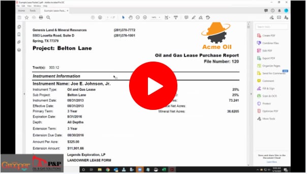
Land Software Data Integration Tools
Video: The Dawn of a New Era for Lease Processing (Intelligent software powers smaller land teams to accomplish more work.)
Watch Our Demo: Oil and Gas Lease Data Extraction (Mineral Ownership and Lease Purchase reports)
This article was last updated December 8, 2021.